A roundup of recent products in the GNSS and inertial positioning industry from the September 2019 issue of GPS World magazine.
OEM
Vehicle tracker
Uses u-blox to detect panic breaking
![Photo: u-blox]()
Photo: u-blox
Arvento’s imt.x1 has a six-axis gyro sensor that can sense three-dimensional movement caused by emergency acceleration, panic braking and directional yaw and drift. With connectivity options including dual CANBus and Bluetooth, the system is eCall compatible and captures and provides data for accident analysis and other vehicle tracking functions. The system also uses the next-generation powerful Arm-based microcontroller. The system’s high position sensitivity and accuracy are based on integration of u-blox’s 2G, 4G and 5G-ready cellular modules as well as GNSS modules.
Arvento, arvento.com; u-blox, u-blox.com
Dual-band GNSS module
Provides mass-market positioning
![Image: Quectel]()
Image: Quectel
The compact LC79D module features concurrent multi-constellation GNSS receivers on dual GNSS bands. It uses L1 and L5 for GPS, Galileo and QZSS, L1 band for GLONASS and BeiDou, and L5 band for IRNSS. It can generally increase the number of visible satellites, significantly improve positioning drifting when driving in urban canyons and enhance positioning accuracy. Embedded with a low-noise amplifier (LNA) and multi-tone active interference, the module provides high sensitivity and reliable anti-jamming capability, ensuring exceptional acquisition and tracking even in weak signal areas.
Quectel Wireless Solutions, quectel.com
Development kit
For testing and interating mosaic
![Photo: Septentrio]()
Photo: Septentrio
The mosaic development kit helps integrate mosaic into an existing system. Mosaic is a compact high-precision multi-frequency GPS/GNSS module that brings precision and reliability of high-end multi-frequency GNSS to mass-market applications. Its light weight and low power consumption makes mosaic suitable for robotics, automation, telematics and wearables. The kit supports connectivity through internet, COM ports, USB 2.0 and an SD Card slot. Mosaic provides Advanced Interference Mitigation (AIM+); extensive corrections support for high-accuracy positioning; integrity needed for safety-critical applications such as autonomous vehicles; and a 100-Hz update rate, suitable for robotics and fast-moving vehicles.
Septentrio, www.septentrio.com
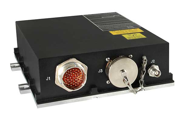
Micro INS
For defense, aviation, aeronautics
![Photo: Emcore]()
Photo: Emcore
The EN-2000 is the newest addition to the Emcore-Orion series of micro-inertial navigation (MINAV) systems. It is compact and lightweight, weighing less than 7 pounds, with very low power consumption of 10 watts. It can deliver twice the performance of the EN-1000 with the same form factor. With its low size, weight and power (SWaP), the compact EN-2000 is suitable for unmanned aerial vehicles, unmanned underwater vehicles, unmanned ground vehicles, manned aircraft, rotorcraft and dismounted soldier applications. Its three-axis design uses a solid-state optical transceiver with advanced integrated optics, combined with new field programmable gate array (FPGA) electronics to deliver stand-alone aircraft-grade navigator performance at one-third the SWaP of legacy systems.
Emcore, emcore.com
M-code receiver
Set for 2020 production deliveries
![Photo: Collins Aerospace]()
Photo: Collins Aerospace
The Miniature PLGR Engine – M-Code (MPE-M) GPS receiver is a small Type II form factor ground receiver, and incorporates the company’s recently certified Common GPS Module (CGM). As a drop-in replacement for the thousands of customers using Collins’ Miniature PLGR Engine-SAASM (MPE-S) GPS receiver, the new MPE-M technology provides 10 times stronger anti-jamming capabilities for the direct acquisition of GPS signals than its predecessor. The MPE-M receives the current military Y-code GPS signal along M-code. It provides warfighters with improved security and assured positioning, and it satisfies the U.S. government’s requirement for all military GPS equipment to be M-code capable. It is designed for lightweight, ground-based applications such as radios, blue force trackers, targeting devices, vehicle line-replaceable units (LRUs) and small unmanned aircraft. The MPE-M’s security certification makes the receiver eligible for export to U.S. allies through the Foreign Military Sales (FMS) program.
Collins Aerospace, www.utc.com
SURVEYING AND MAPPING
Software receiver
Available with usage-based plan
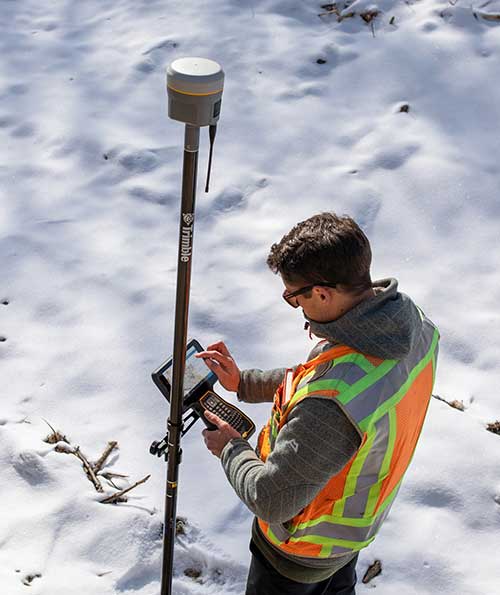
![]() The Catalyst software-defined GNSS receiver for Android phones and tablets is now available with a usage-based service plan: Trimble Catalyst On Demand. The new service plan meets the needs of industries and organizations that need a more flexible payment model. Organizations use Catalyst to record positions, navigate to points, measure relative distance and create digital maps. Trimble Catalyst On Demand provides scalable access to real-time kinematic (RTK)-quality GNSS positioning using a pay-per-use hourly pricing model in addition to the current Catalyst monthly plans. The service also enables automated domain-level email address access, which streamlines license allocation for organizations with a large number of users. (Pictured: Catalyst DA1 antenna).
The Catalyst software-defined GNSS receiver for Android phones and tablets is now available with a usage-based service plan: Trimble Catalyst On Demand. The new service plan meets the needs of industries and organizations that need a more flexible payment model. Organizations use Catalyst to record positions, navigate to points, measure relative distance and create digital maps. Trimble Catalyst On Demand provides scalable access to real-time kinematic (RTK)-quality GNSS positioning using a pay-per-use hourly pricing model in addition to the current Catalyst monthly plans. The service also enables automated domain-level email address access, which streamlines license allocation for organizations with a large number of users. (Pictured: Catalyst DA1 antenna).
Trimble, www.trimble.com
Rugged tablet
3D Imaging and built-in gnss
![Photo: DT Research]()
Photo: DT Research
The DT301X is designed for 3D mapping. Its Intel RealSense Depth camera provides real-time 3D imaging combined with a dual-frequency GNSS module for real-time mapping and positioning. The digital images are better than high-definition standard, and are suitable for construction building information management (BIM) graphics. The highly durable IP65 and MIL-STD-810G-rated tablet in a slim case can be used in the field, office and vehicles. A bright 10.1-inch touchscreen provides indoor/outdoor viewing. The tablet includes long-range Bluetooth and 4G LTE mobile broadband for the latest in high-speed communications. An Intel 8th-generation Core i5 or i7 processor offers high performance while still being energy efficient.
DT Research, www.dtresearch.com
Airborne lidar
Mapper for wide-area, mountain, urban and corridor surveys
![Photo: Teledyne Optech]()
Photo: Teledyne Optech
The ALTM Galaxy PRIME wide-area lidar sensor offers collection efficiency, a small form factor and high-quality data sets that meet rigorous USGS lidar standards. It has a 6,000-meter above-ground-level (AGL) collection envelope and 1-MHz on-ground collection rate. Galaxy PRIME includes lidar technology enhancements to increase sensor performance and collection efficiency, improve data quality, and simplify the collection process. It can be used either gyro-stabilized or fixed-mounted, one camera or six, and full waveform or discrete. PulseTRAK technology enables a continuous operating envelope by eliminating data coverage gaps and irregular point density. Applications include wide-area mapping, urban mapping, natural resource management, engineering, infrastructure modeling, and powerline and transportation corridors.
Teledyne Optech, teledyneoptech.com
Imaging sensor
Real-time 3D reality capture
![The Leica BLK247. (Photo: Hexagon)]()
The Leica BLK247. (Photo: Hexagon)
The Leica BLK247 real-time reality-capture device uses sensor fusion technology to detect and report physical changes within a space. It is designed for continuous 3D reality capture, extending capabilities for safety and security applications. The sensor provides real-time situational awareness through edge computing and lidar-enabled change-detection technology. Using artificial intelligence, the BLK247 can tell the difference between still and moving objects — such as a person walking who leaves a suitcase behind — and identify security threats to provide real-time alerts.
Hexagon, hexagon.com
Scientific software
Better data interpretation
![Image:: Golden Software]()
Image:: Golden Software
Version 15 of Grapher has new capabilities to improve the ability to model, analyze and interpret data as well as communicate the results. Grapher users can now access new Fit Curve, Axes and Statistical Plotting capabilities. Also, users are provided greater color customization functions in the latest release. Enhancements give Grapher users a more powerful ability to display and communicate the results of their work to others. The software provides 80 different 2D and 3D plot types for analyzing and displaying scientific data.
Golden Software, goldensoftware.com
UAV
Heavy-lift scanning UAV
Ready for longer flights
![Photo: LiDARUSA]()
Photo: LiDARUSA
The Harris Aerial H4/H6 Hybrid multicopter is now offered as an integrated package with any Lidar USA scanning system. The Harris Hybrid can provide longer flights with lidar and industrial-grade cameras. The Harris Hybrids use a small generator running on 95 or higher octane fuel to power the UAV for up to five hours.The H6 can carry an A-series high-definition lidar system of 3 kg for 2.5 hours and a V-series of 5 kg up to 1.5 hours. For the lidar operator, this means most projects will require only one or two flights.
Lidar USA, www.lidarusa.com
Commercial drone
Long duration for sensitive tasks
![Photo: Impossible Aerospace]()
Photo: Impossible Aerospace
The US-1 was built with sensitive enterprise and government customers in mind. It was designed from the ground up in the United States with a battery-first approach to enable electric aircraft to compete with conventionally fueled incumbents. The US-1 runs on a secure open-source operating system by Auterion. It provides 78 minutes of flight time and high-resolution optical and thermal cameras. US-1 UAVs have been deployed to fight fires, locate pipeline leaks, and track armed suspects.
Impossible Aerospace, impossible.aero
Auterion, auterion.com
Drone rescue system
Meets ASTM standards
![Photo: LiDARUSA]()
Photo: LiDARUSA
The DRS-M600 reusable parachute safety solution, developed for DJI M600 and DJI M600 Pro, meets specifications of the ASTM F3322-18 standard. The successful completion of the ASTM standard test makes it possible for the Federal Aviation Administration to issue permits for its use on drones over crowds. The ASTM F3322-18 standard is the first standard for parachute systems designed specifically for small UAVs.
Drone Rescue Systems, www.dronerescue.com
TRANSPORTATION
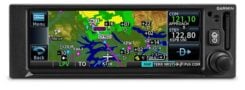
GPS/comm radio
WAAS/SBAS with LPV approaches
![The GNC 355 is a GPS navigator with localizer performance with vertical (LPV) approach guidance. (Photo: Garmin)]()
The GNC 355 is a GPS navigator with localizer performance with vertical (LPV) approach guidance. (Photo: Garmin)
The GNS 355 GPS navigator with localizer performance with vertical (LPV) approach guidance gives pilots the benefits of WAAS/SBAS GPS guidance with a modern communications radio. Intended for Class I/II aircraft that weigh 6,000 lbs./2,721 kg. or less, the GNC 355 is certified for more than 700 aircraft makes and models. Aircraft owners can incorporate the GNC 355 into an existing avionics stack because of its standard 6.25-inch wide by 2-inch tall design. The responsive touchscreen display allows pilots to quickly access direct-to functionality, moving map, flight plan, nearest, procedures, waypoint and terrain pages and create customizable data fields and shortcuts for quick, one-touch access to important information. Fully WAAS/SBAS IFR-approach-capable, the GNC 355 gives pilots the benefit of flying LPV, as well as Area Navigation (RNAV) approaches. Many approaches offer vertical approach guidance as low as 200-feet above ground level (AGL).
Garmin, Garmin.com
RTK INS platform
For autonomous vehicles under demanding conditions
![Allystar RTK/INS Evaluation Board V1.0. (Photo: Allystar)]()
Allystar RTK/INS Evaluation Board V1.0. (Photo: Allystar)
The Allystar INS Platform is a dual-antenna, multi-frequency, multi-GNSS inertial navigation system (INS) that delivers accurate and reliable position, velocity and orientation. It combines high-grade, six-axis, temperature-calibrated accelerometers and gyroscopes with a multi-frequency, multi-GNSS engine, the HD9300 series. The HD9300 is a dual-antenna chip-grade real-time kinematic (RTK) GNSS receiver for accurate positioning and heading. The Allystar INS platform contains an on-board sensor-fusion filter, plus navigation and calibration algorithms for different dynamic motions of land vehicles. The Allystar OBD Data Adapter (v1.0) enables users to read and monitor various sensors built into cars, obtaining real-time vehicle speed and gear signals from the on-board diagnostics (OBD) interface, and then output AT (attention) commands by serial port or serial peripheral interface (SPI).
Allystar, www.allystar.com